Mapping Forest Aboveground Biomass Loss in North Carolina from Hurricanes using Multisource Remotely Sensed Data. PI: Conghe Song (Univ. of North Carolina Chapel Hill), Co-PI: Todd Schroeder (USDA Forest Service), Collaborators: Monica Papes (Univ. of Tenn, Knoxville), Shingo Obata (Univ. of Tenn, Knoxville, Eben Broadbent (Univ. of Florida), and Ajaj Sharma (Univ. of Florida), USDA Forest Service, $160,000, 10/01/2022-09/30/2024
Forests provide key ecosystem services upon which humanity depends. Removing CO2 from the atmosphere through photosynthesis and keeping the carbon in long-term storage are among the most critical ecosystem services forests provide. However, due to climate change, hurricanes are becoming more powerful and frequent, which can kill a large number of trees along its passway. And yet, it remains a major challenge to quantify how my carbon is stored in forests as biomass, and thus not knowing how much carbon removal occurs when a hurricane hits. This project is aimed at addressing this challenge. We will use optical, lidar, radar, and high-resolution images to map forest aboveground biomass via a suite of machine-learning algorithms in North Carolina.
Influence of Community Forestry on the Dynamics of Socio-Environmental Systems. PI: Conghe Song (UNC Chapel Hill), Co-PIs: Richard Bilsborrow (UNC Chapel Hill), Larry Band (UVA), Erin Sills (NCSU), and Rajan Parajuli (NCSU), Collaborators: Ge Sun (USDA Forest Service, Southern Research Station, Raleigh, NC), Elizabeth Shapiro-Gaza (Duke), Naya Paudel (ForestAction, Kathmandu, Nepal), Binod Heyojoo (Institute of Forestry, Pokhara, Nepal), Bir Khanal Chhetri (Institute of Forestry, Pokhara, Nepal). National Science Foundation, $1,599,793, 08/15/2021-07/31/2024.
ABSTRACT: Forests are an extremely important type of land on the Earth’s surface because they serve as homes for millions of animals and other plants to live, provide people with wood for building houses and for cooking food, and cool the climate by absorbing carbon dioxide from the atmosphere. Unfortunately, forests continue to be cut down, especially in poor countries. To prevent forests from further decline, people in some communities have organized to protect their forests through what is called community-based forest management programs, or Community Forestry (CF). CF programs are where people living in a community or village work together to decide what to do with their forests. About a third of all the forests in the world’s poor countries are managed this way. However, CF does not always work. This project will be carried out in Nepal to learn why some villages are successful in CF while others not. The researchers will work closely with local stakeholders to improve their forest management strategies that can benefit local communities and beyond. The project will also train graduate and undergraduate students in both the US and Nepal and will leave a lasting legacy in Nepal for forest management. The United States will directly benefit from the effects of forest cooling the climate as a result of better community forest management in Nepal and elsewhere from knowledge gained in this study.
The main goal of this project is to study how CF can be improved to better both preserve the forests and support the lives of forest-dependent people. To achieve this goal, this research will address the following questions: (1) How does CF affect people’s livelihoods and their social interactions? (2) How does it interrelate with rural out-migration? (3) How does it affect people’s land-use decisions? (4) How has COVID-19 influenced rural people’s livelihoods and their dependence on CF? (5) How has CF influenced the environmental system’s provision of goods and services? To address these questions, the researchers will interview households engaged in CF about their forest management practices, how the management rules are made, and the roles of community members played in the rules making, along with detailed information about their agricultural practices, out-migration status, and whether CF help buffer the external shock from COVID-19. Moreover, remote sensing data collected by satellites in space, in situ hydrological data on the ground, and statistical, ecological and hydrological models will also be used to estimate how much water forests use and how much carbon dioxide they absorb from the atmosphere as a result of CF. Eventually, an Integrated Modeling System will be developed to study the interactions among forests, human activities, and the ecosystem goods and services the natural environment provides. This project will contribute to advance theories on common pool resource management, rural out-migration and its effect on natural resource management, and land-use change and forest-ecosystem service relationship. The new knowledge to be gained from this research will be highly valuable for making new policies for sustainable CF in Nepal and other developing countries as the research questions to be addressed in this research are not unique to Nepal but are common to other developing countries.
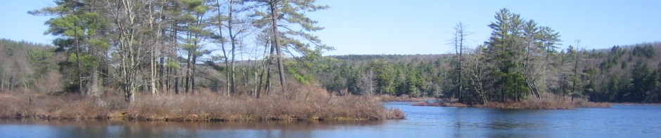
Impacts of Land-Use/Land-Cover and Climate Changes on the Gross and Net Primary Productivity in the Southeastern USA., PI: Conghe Song (UNC Chapel Hill); Co-Is: Taehee Hwang (Indiana Univ.) and Kim Novick (Indiana Univ); Collaborators: James Vose (US Forest Service) and John Coulson (US Forest Service). NASA Carbon Cycle Science, $909,212, 01/25/2017-01/24/2020.
This study will use the rich remote sensing data available for the Southeastern USA, including historical air photos, long time series of Landsat imagery, recently collected LiDAR, MODIS as well as Sentinel-2 from ESA to synergistically to reconstruct the LULC change through time, including changes in LULC categories as well as species composition as a result of forest succession. The LULC history reconstructed from remote sensing will be used as input to an ecosystem productivity model to disaggregate the impacts of climate and LULC changes on primary productivity, respectively. We will use US Forest Service’s Forest Inventory Analysis, AmeriFlux data as well as the high quality stream flow data from USGS for model calibration and evaluation. We intend to address the following questions: (1) what are the historical trends in the patterns of LULC, and species composition in US Southeast since the 1950s? (2) How have the changes in forest extent and composition altered gross and net primary productivity? (3) How, and to what extent, does the combination of the historical trends in climate and LCLU impact the vulnerability of carbon storage in the southeast in the past and in the future? Answers to these questions are critical for sustainable development planning in this region, given the high ecological and economic importance of southeastern U.S. forest ecosystems.
Disaggregating the Effects of Land-Cover/Land-Use Change and Climate Change on Net Primary Productivity and Evapotranspriation in Yangtze River Delta. PI: Conghe Song, Co-PI: Juxiang Li (East China Normal University, Shanghai, China). Natural Science Foundation of China, RMB200,000, 01/012016-12/31/2017.
Yangtze River Delta (YRD) has experienced unprecedented land-cover/land-use change (LCLUC) during 1984-2014 due to the adoption of open and reform policy by the Chinese government in the late 1970s. In the meantime, the global climate warmed significantly. Both of these changes have profound implications for the ecosystem functions in this region, particularly the net primary production (NPP) and the associated evapotranspiration (ET). YRD historically has been “the country of fish and rice.” The change in NPP and ET as a result of LCLUC and climate change can seriously affect the sustainability of socio-economic development in this region. To effectively make and implement new environmental policies that aimed at sustainable development for the region, we need to have a clear understanding of the respective impact of LCLUC and climate change on NPP and ET. However, observational data always contain the integrative effect from both factors. To date, there is no effective tool to accomplish this task. This project is aimed at developing new a modeling tool that is capable of integrating the advanced products from remote sensing and ground measured climate data to achieve this goal. This project will provide theoretical underpinnings for how to realize sustainable development in the YRD through addressing both the Land-Cover/Land-Use Change and Climate Change effects.
CNH: the effects of China’s Grain-for-Green program on the dynamics of coupled natural-human system in rural China (2013-2017). PI: Conghe Song, Co-I: Lawrence Band, Richard Bilsborrow, Pamela Jagger, and Xiaodong Cheng. US Collaborator: Ge Sun; China Collaborators: Xiaoniu Xu, Quanfa Zhang, Zhiqiang Zhang. National Science Foundation, $1,164,984. 08/15/2013-07/31/2018.
China implemented the Sloping Land Conversion Program (SLCP), also known as “Grain-for-Green” Program, for ecological restoration after a series of natural disasters occurred in late 1990s. The primary goal of SLCP is to conserve soil and water through converting croplands on steep slopes to forests or grasslands, in return participating households receive government compensation for a pre-specified period of time, and farmers also gain ownership of these forests. Unlike earlier ecological restoration programs in China, which relied on administrative orders, SLCP adopted market mechanism, making it to be arguably the world’s largest payment for ecosystem service (PES) program. The goal of this investigation is to evaluate how SLCP influenced the dynamics of the coupled human and natural system (CHANS) in three contrasting climate regions: a subtropical site in Anhui, atemperate site in Shanxi, and a semiarid site in Shaanxi. Our major research questions include: (1) How has SLCP influenced farmers’ livelihoods over a wet-to-dry climate gradient? How has SLCP influenced the demographics (i.e., migration decisions) of the participating households? Has SLCP let to agricultural intensification due to reduction in croplands? (2) How has the increase in forest cover as a result of SLCP influenced the carbon storage and water supply over the wet-to-dry climate gradient? (3) How has the change in the natural subsystem (e.g., increase in forest cover and reduce in water supply) feed back to the human subsystem? (4) What are the emergent CHANS dynamics as a result of individual households change in forest and agriculture area? (5) How will the dynamics of CHANS change under certain hypothetical policy scenarios in the future? In order to address these questions, we will first use remote sensing to map the spatial and temporal history of the study area wall-to-wall. We will conduct extensive fieldwork in our study area to link ground truth to satellite images via geographic information systems and GPS. Second, we plan to conduct extensive household and community surveys to understand how the SLCP compensation affected the farmers’ livelihoods, their migration and land-use decisions, as well as local government agencies to understand the context, intentions and implementation of the PES program. We will develop statistical models to estimate the factors that contribute to household land-use decisions. Third, we will use ecosystem models to estimate carbon storage and freshwater supply changes as a result of land-cover/land-use change caused by the PES program. Finally, we will develop a CHANS modeling system (CMS) to model the spatio-temporal dynamics of CHANS by coupling a simplified process based ecosystem model for the natural subsystem with an agent-based model (ABM) for the human subsystem. CMS will be able to reveal nonlinear ecosystem function changes as a result of land cover/land use change, emergent phenomena, lag effect, the threshold values in the natural system that will trigger individual household response, and even surprises.
Forests provide vital ecosystem goods and services on which the society’s ell-being depends. Nevertheless, forest areas are shrinking globally at an alarming rate (13 million ha/year during last decade), primarily in the developing countries of Africa and Latin America. How to increase forest cover to sustain the vital goods and services that society needs, and in the meantime provide a decent livelihood option for the service providers is one of the biggest challenges the society faces today. Market mechanisms have been increasingly used as a leverage to address the challenge. As the world’s largest PES program, understanding the social-ecological effect of SLCP will be extremely important for implementing similar policy in other developing countries for ecological restoration and protection. This research is particularly salient in the context of the global discourse on reducing emissions from deforestation and forest degradation (REDD+), a forest based climate change mitigation strategy. This study will provide excellent research opportunities for graduate and undergraduate students in both US and China. We will make special efforts to recruit under represented groups in the US to join our team either as interns or graduate students. The project will advance social science in traditionally science-based collaborative institutions in China, facilitate international multidisciplinary collaborations, and foster cultural exchanges between the US and Chinese scholars. Through this project, we will establish long-term ties for research between the collaborative institutions, taking advantage of the collaborative institutions historical data and knowledge at the respective study sites. This project will also expand the area of research of the lead PI from approaching forest ecosystems as natural systems to social-ecological systems in which humans are active elements.
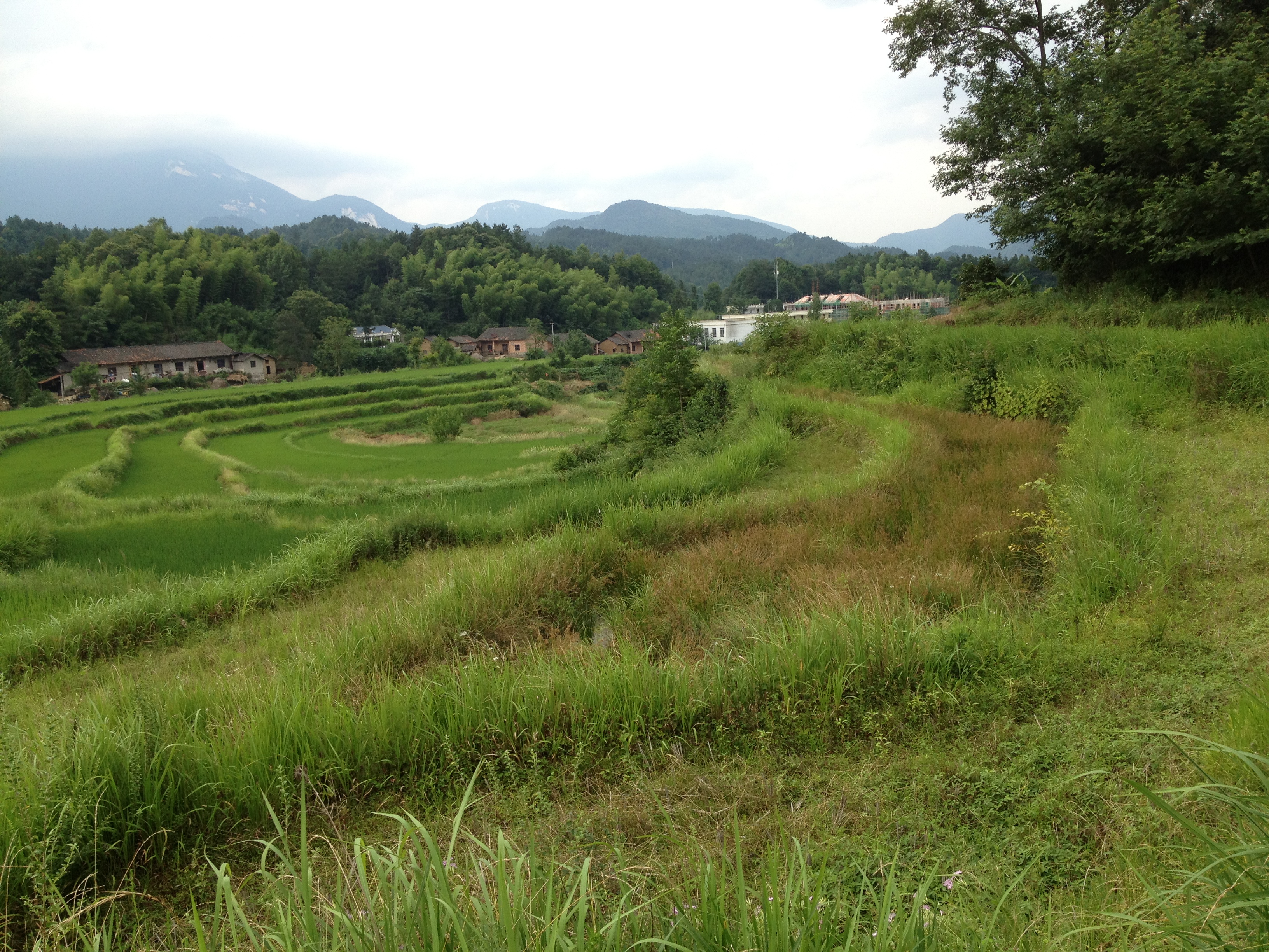
Cropland Abandonment in our Anhui study site
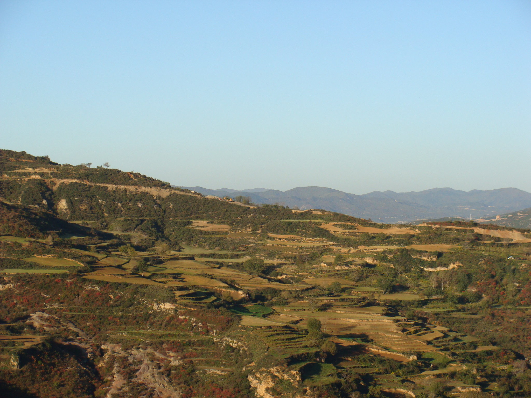
Sloping cropland on Loess Plateau around our Shanxi study site
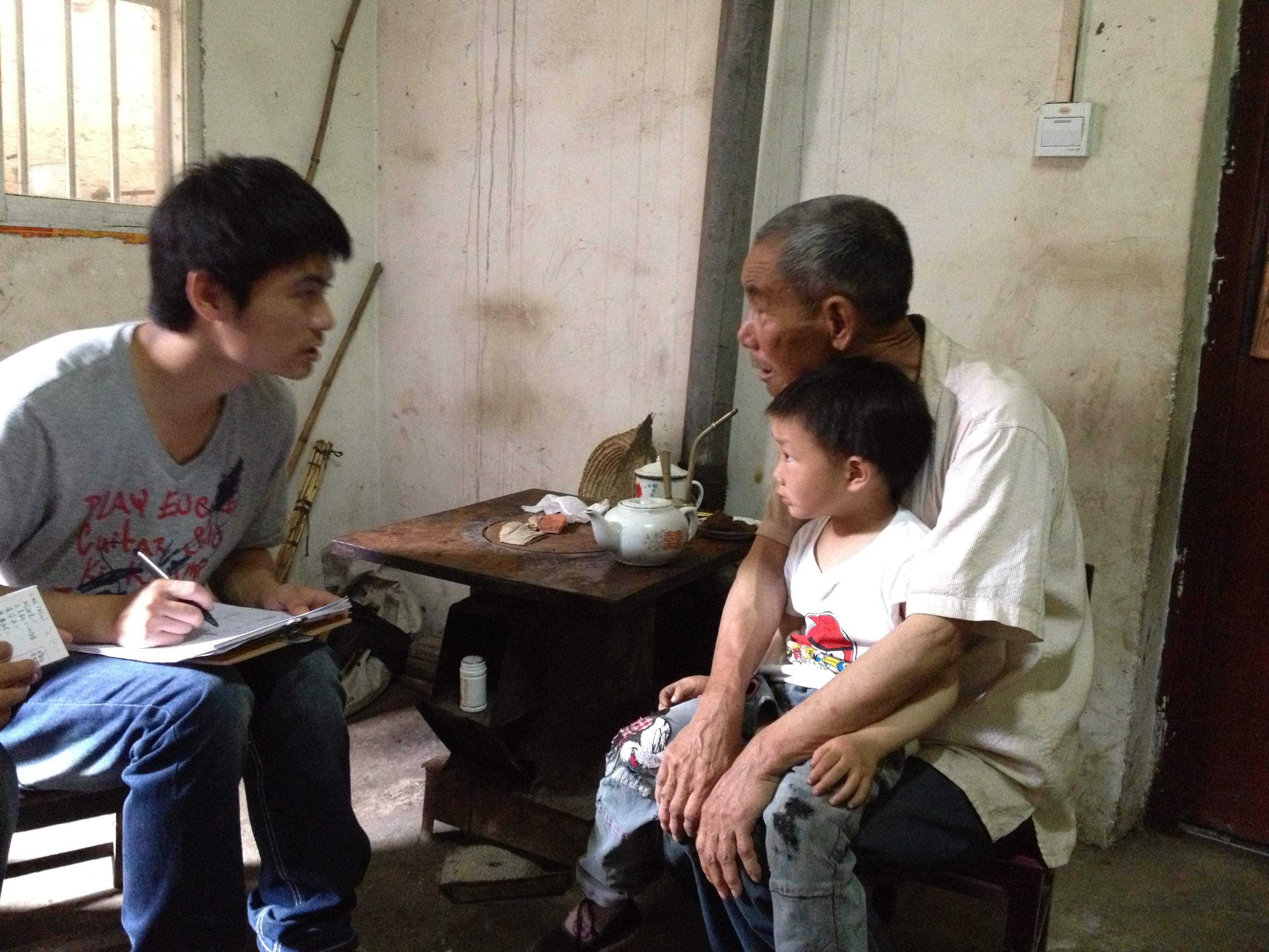
PhD Candidate, Qi Zhang, is conducting household survey in Anhui, China

Graduate Student Na Zhao of Beijing Forestry University is conducting household survey in Shanxi, China
Understanding the impact of land-cover/land-use change on plant diversity: scaling from plots to landscapes using multi-sensor remote sensing (2014-2017). PI: Conghe Song, Graduate Student: Christopher Hakkenberg. NASA Earth and Space Science Fellowship, $90,000, 09/01/2014-08/31/2017.
The North Carolina Piedmont is characterized by high plant diversity as well as rapid and accelerating land cover and land use change (LCLUC) driven by urbanization and interacting trends in timber and agricultural markets. Studies have demonstrated the central role of biological diversity in landscapes characterized by rapid LCLUC for providing ecosystem resilience and maintaining ecosystem function. Owing to the imperative to mitigate the adverse effects of habitat loss and climate change, it is critical that we improve our capacity to monitor how LCLUC impacts fundamental components of ecosystem resilience like biodiversity. While remote sensing technologies are optimally suited to monitor LCLUC over large spatio-temporal extents, direct approaches to the remote measurement of biodiversity remain a challenge.
This study takes an innovative approach to the remote estimation of plant diversity using a more readily estimated proxy: forest structure. The core scientific motivation guiding this research is driven by the question: is there a clear signal for the impact of LCLUC on plant diversity, and if so, how do interacting and sometimes countervailing LCLUC trends impact plant diversity over large spatio-temporal extents? To answer these and related questions, this study will examine how multiple interacting LCLUC trends aggregate in the species-rich Piedmont landscape to affect plant diversity over a thirty-year time span. We will develop methodologies of Earth observation that exploit the strengths of active and passive remote sensing to: (1) determine a statistical relationship between plant diversity and environmental correlates including remotely derived forest structural estimates, (2) apply this relationship to model plant diversity over a Piedmont landscape, and (3) infer the effect of LCLUC trends on plant diversity using a calibrated time series of remotely sensed imagery at multiple time steps from 1984-2014.
This research commences from the desire to move towards a more automated, active monitoring of vegetation change – including structural, compositional and phenological change – to better capture a realistic picture of forest dynamics as input parameters for conservation planning and ecosystem modelling. At no time in our history have we had access to such robust data sets, computational power, as well as open-source statistical and image processing software, nor has the need been so great to model the impact of land use and land cover change on biodiversity.
Improving the algorithms Used in WaSSI to model the impacts of land-cover/land-use and climate changes on the carbon and water dynamics (2014-2015). PI: Conghe Song, Co-PI: Ge Sun. USDA Forest Service. $40,000, 08/15/2014-08/14/2015
This is a UNC-USDA Forest Service Joint Venture Program. The aim of the project is to improve the USFS WaSSI model so that the model can be used to better estimate the impact of land-cover/land-use and climate changes on carbon and water dynamics in the US Southeast. The original WaSSI model is a water-centric empirically based model that simulate carbon and water balance on a watershed scale. We plan to improve the model to become a carbon-centric process based model based on global FLUXNET and remote sensing data.